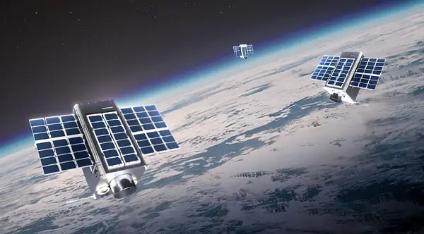
A groundbreaking satellite developed through a UK-France partnership, designed to scan urban areas, was launched this week from French Guiana.
This satellite aims to revolutionize climate monitoring by providing unprecedented data on urban heat islands and pollution levels.
Details of the UK-France Satellite Initiative
The recently launched satellite, part of a collaborative effort between the United Kingdom and France, is set to enhance how cities influence the climate. The satellite was sent into orbit from a spaceport in French Guiana, marking a significant step in international space cooperation.
Equipped with advanced sensors, the satellite is specifically designed to monitor urban areas, focusing on environmental changes and pollution accumulation.
Technological Innovations Behind the Satellite
The satellite features state-of-the-art technology capable of detailed scanning of urban landscapes. This includes thermal imaging to detect heat concentrations and sophisticated sensors to track air quality and pollution levels.
These capabilities are expected to provide critical data necessary for developing strategies to combat urban pollution and manage heat islands in major cities worldwide.
How Climate Change Research is Evolving with New Discoveries
By providing detailed environmental data, the satellite will play a crucial role in the ongoing research into climate change. Scientists anticipate using the data to better understand the specific contributions of urban areas to global warming.
This information could lead to more effective urban planning and climate policies, tailored to the unique needs and challenges of cities around the globe.
Collaboration and Support from Governments
The UK and French governments have both expressed strong support for the satellite project, highlighting its potential benefits for environmental monitoring and policy-making. This initiative is an example of successful collaboration in the field of international space research.
Officials from both countries have underscored the importance of this mission in advancing our understanding of environmental science and its applications in urban settings.
Satellite Specifications and Mission Goals
| Category | Detail |
|---|---|
| Launch Location | French Guiana |
| Main Technology | Thermal imaging and pollution sensors |
| Focus Area | Urban climate effects |
The Role of Satellite Technology in Transforming Urban Studies
The successful deployment of this satellite opens the door to more sophisticated urban environmental monitoring systems. Future satellites could incorporate even more advanced technologies, providing deeper insights into urban climate dynamics.
Researchers are particularly excited about the potential for real-time data transmission, which could significantly enhance the responsiveness of urban planning to environmental issues.
Statements from Project Leaders
Project leaders from both the UK and France have praised the launch as a milestone in environmental research.
“This satellite represents a leap forward in our ability to monitor the environmental health of our cities,” stated one of the lead scientists.
The collaboration has been described as a model for future international partnerships in tackling global challenges such as climate change and urban development.
Additional Reading
Sources: UK Government Press Release.
Prepared by Ivan Alexander Golden, Founder of THX News™, an independent news organization delivering timely insights from global official sources. Combines AI-analyzed research with human-edited accuracy and context.


